


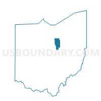
RUGGLES TWP Voting District, Ashland County, Ohio
About
Outline

Summary
| Unique Area Identifier | 642608 |
| Name | RUGGLES TWP Voting District |
| County | Ashland County |
| State | Ohio |
| Area (square miles) | 26.01 |
| Land Area (square miles) | 25.81 |
| Water Area (square miles) | 0.20 |
| % of Land Area | 99.23 |
| % of Water Area | 0.77 |
| Latitude of the Internal Point | 41.02507510 |
| Longtitude of the Internal Point | -82.38128410 |
Maps


Graphs
Select a template below for downloading or customizing gragh for RUGGLES TWP Voting District, Ashland County, Ohio


Neighbors
Neighoring Voting District (by Name) Neighboring Voting District on the Map
- BUTLER TOWNSHIP, Richland County, OH
- CLEARCREEK TWP Voting District, Ashland County, OH
- FITCHVILLE TWP, Huron County, OH
- GREENWICH TWP, Huron County, OH
- NEW LONDON TWP, Huron County, OH
- NEW LONDON VILLAGE 2, Huron County, OH
- ORANGE TWP #2 Voting District, Ashland County, OH
- PRECINCT ROCHESTER TWP & VILL, Lorain County, OH
- TROY TWP Voting District, Ashland County, OH
Top 10 Neighboring County Subdivision (by Population) Neighboring County Subdivision on the Map
- New London township, Huron County, OH (3,268)
- Orange township, Ashland County, OH (2,523)
- Clear Creek township, Ashland County, OH (2,276)
- Butler township, Richland County, OH (1,205)
- Troy township, Ashland County, OH (1,132)
- Fitchville township, Huron County, OH (1,056)
- Greenwich township, Huron County, OH (1,044)
- Ruggles township, Ashland County, OH (905)
- Rochester township, Lorain County, OH (799)
Top 10 Neighboring Place (by Population) Neighboring Place on the Map
Top 10 Neighboring Unified School District (by Population) Neighboring Unified School District on the Map
- Crestview Local School District, OH (7,396)
- Mapleton Local School District, OH (6,710)
- New London Local School District, OH (6,038)
- South Central Local School District, OH (4,983)
Top 10 Neighboring State Legislative District Lower Chamber (by Population) Neighboring State Legislative District Lower Chamber on the Map
- State House District 97, OH (124,815)
- State House District 58, OH (120,471)
- State House District 73, OH (105,536)
Top 10 Neighboring State Legislative District Upper Chamber (by Population) Neighboring State Legislative District Upper Chamber on the Map
- State Senate District 19, OH (406,557)
- State Senate District 13, OH (370,509)
- State Senate District 22, OH (370,237)
Top 10 Neighboring 111th Congressional District (by Population) Neighboring 111th Congressional District on the Map
- Congressional District 4, OH (632,771)
- Congressional District 5, OH (627,799)
- Congressional District 9, OH (619,010)
Top 10 Neighboring Census Tract (by Population) Neighboring Census Tract on the Map
- Census Tract 9702, Ashland County, OH (5,845)
- Census Tract 9164, Huron County, OH (5,114)
- Census Tract 9165, Huron County, OH (4,845)
- Census Tract 9166, Huron County, OH (4,417)
- Census Tract 29, Richland County, OH (4,191)
- Census Tract 971, Lorain County, OH (3,055)